Good evening! We’ve been dealing with rain today as a warm front is moving in. This front will be stalling for Friday and then the associated cold front will cross through on Saturday. The good news is we need the rain, and will see that here to kick off the weekend.
Friday morning temperatures will be in the upper 40s. We will have a variable cloudy sky.
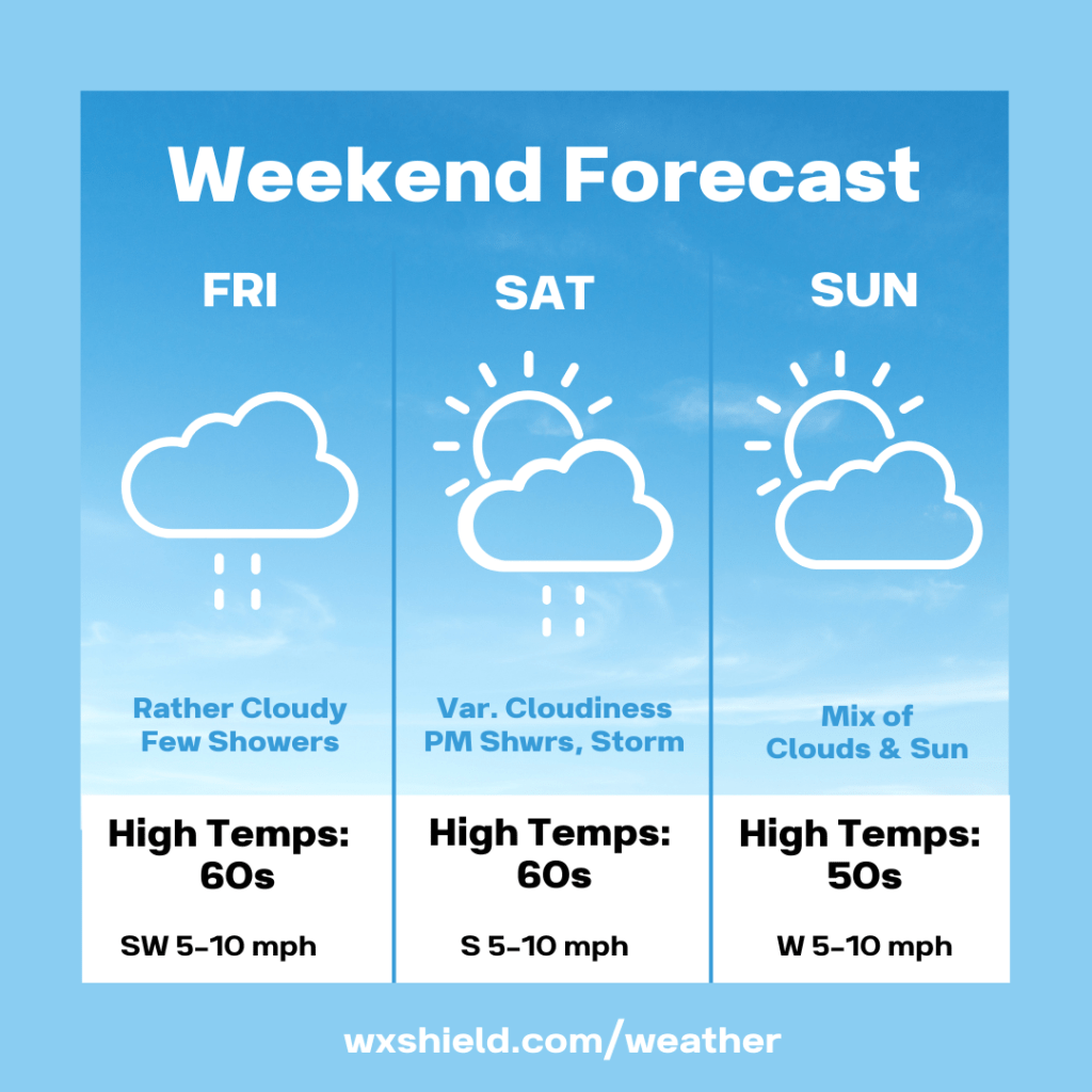
Friday afternoon temperatures will reach the upper 50s to lower 60s. Winds will be from the southwest between five to ten mph. We will have a few showers Friday afternoon do to the stalled front.
Friday night will be cloudy. Temperatures will dip into the mid to upper 40s.
Saturday we will have a variable cloudy sky at first, but a cold front will be arriving. This will bring us some showers and storms by afternoon. High temperatures on Saturday will be in the mid to upper 60s. Winds will be from the south between five to ten mph.
Saturday night temperatures will be in the mid to upper 40s. Saturday night will be cloudy with showers.
Sunday will be cooler but will be dry. It will be a nice day to get outside and enjoy. High temperatures on Sunday will be in the mid to upper 50s. Winds on Sunday will be form the west between five to ten mph. Sunday we will have a mixture of sunshine and clouds.
Sunday night temperatures will be in the lower 40s. Sunday night we will be mainly clear.
Monday will be mild. Temperatures will reach the upper 60s. Monday there will be a mix of clouds and sunshine.
I hope you have a great weekend!

Leave a comment