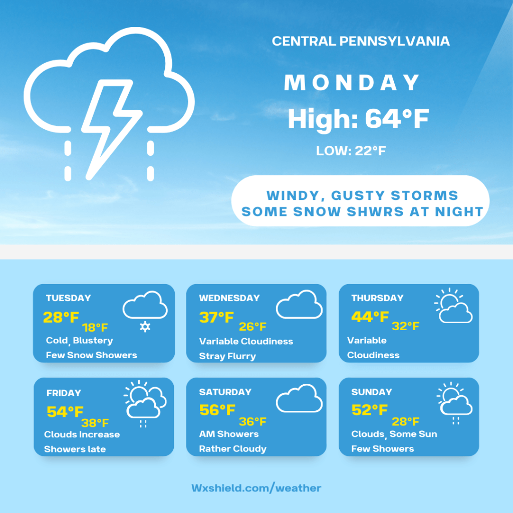
I hope you had a nice Sunday! We have a stormy day ahead on Monday and then the rest of the week is quite cold.
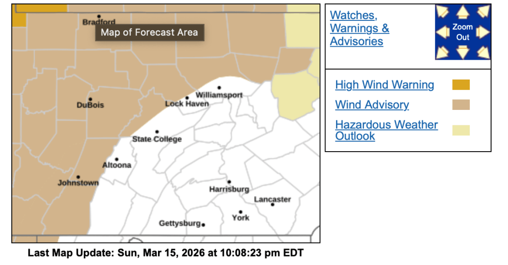
Monday morning temperatures will be in the mid to upper 40s. Winds on Monday morning will be from the southeast between fifteen to twenty mph. Due to the stronger winds, the National Weather Service continues the Wind Advisory until 11 am. Monday morning we will be cloudy with some showers.
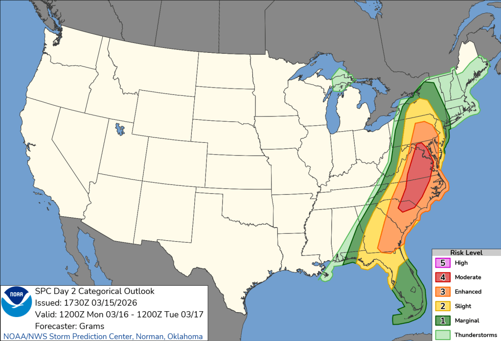
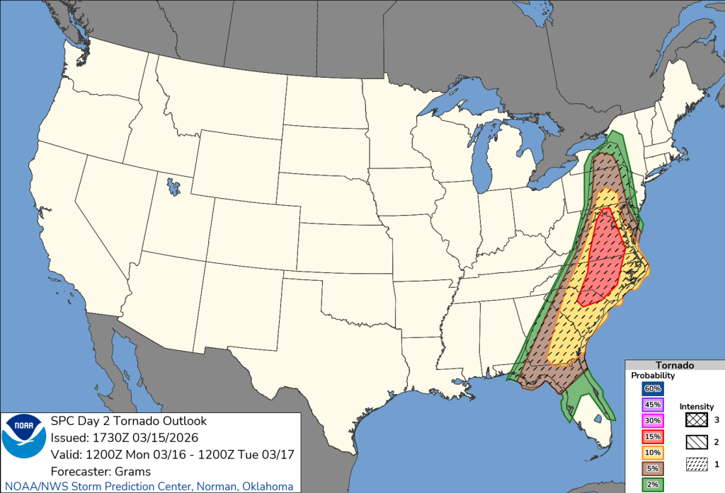
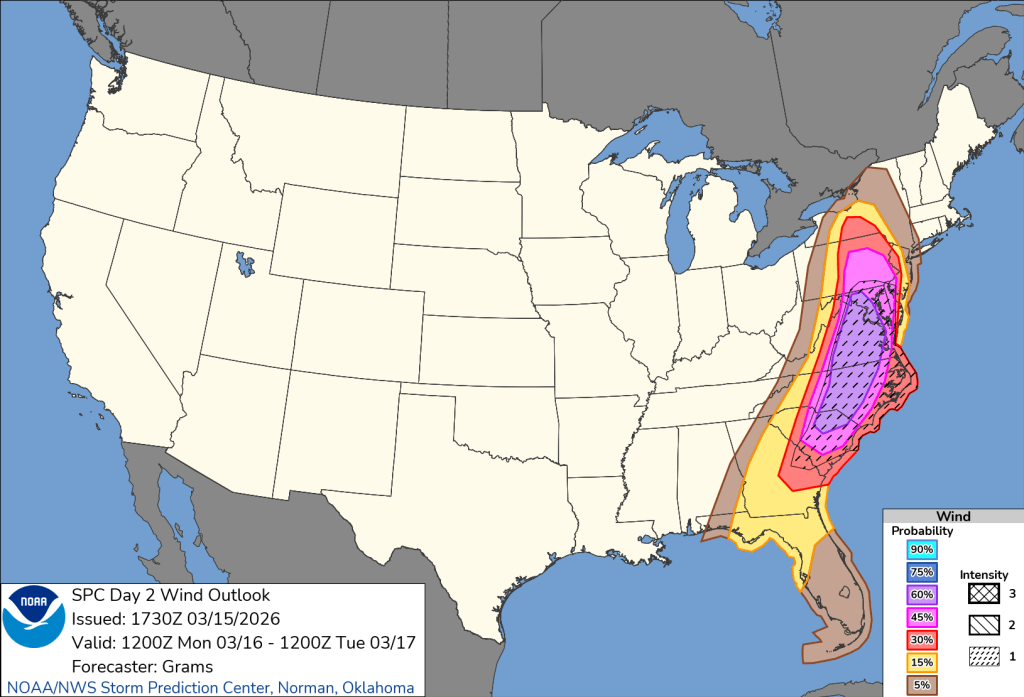
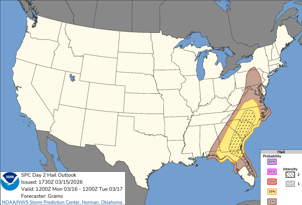
Monday afternoon a cold front will arrive. Ahead of it, we will see temperatures climbing, and if there is any sunshine, will add instability to the atmosphere. This afternoon with the crossing of the cold front, we could see strong to severe storms with damaging winds. The National Weather Service has put us under a slight risk for severe weather (2 out of 5). Just to our east, it is an enhanced risk. Please stay weather aware. Our biggest threat is damaging winds and even potentially a tornado.
Monday night cold air quickly arrives. We will see temperatures dropping into the lower to mid 20s. We will also see a wintry mix to some snowfall. Winds will be from the west between fifteen to twenty mph. Gusts will be up to 40 mph. Use caution, in some spots, there could be a dusting of snowfall on the ground by morning.
Tuesday will be a cold and blustery day. High temperatures will only make it to the mid to upper 20s. Winds will be from the west between fifteen to twenty mph. Tuesday we will have a rather cloudy day with a few flurries or snow showers. Tuesday night temperatures dip into the teens.
Wednesday high temperatures will be in the lower to mid 30s. Winds will be from the southwest between five to ten mph. Wednesday we will have variable cloudiness with a flurry or two. Wednesday night temperatures will be in the 20s with a cloudy sky.
Thursday high temperatures will be in the mid 40s. We will have variable cloudiness. Winds will be light from the south between 3-5 mph. Thursday night temperatures will be around the freezing mark of 32 degrees.
Friday temperatures will reach into the lower to mid 50s. Winds will be from the west northwest between five to ten mph. Friday clouds will increase. Friday night there will be showers around. Friday night temperatures will be in the mid to upper 30s.
Saturday morning we could have a few lingering showers. High temperatures on Saturday will be in the mid 50s. Winds will be from the west between five to ten mph. Saturday afternoon we will have a cloudy sky. A few clouds could break for a little sunshine. Saturday night temperatures will dip into the mid to upper 30s.
Sunday we will be partly cloudy with a few showers. Temperatures will be in the lower 50s. Winds will be from the northwest between ten to fifteen mph. Sunday night temperatures will dip into the 20s.
Monday there will be a mix of clouds and sunshine.
Have a fantastic week! Stay safe tomorrow!

Leave a comment