Good morning. We have a stormy day ahead and then the rest of the week is quite cold.
Click here for your 7-Day Forecast.
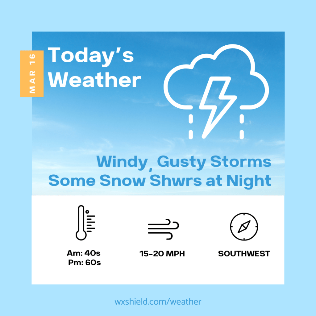
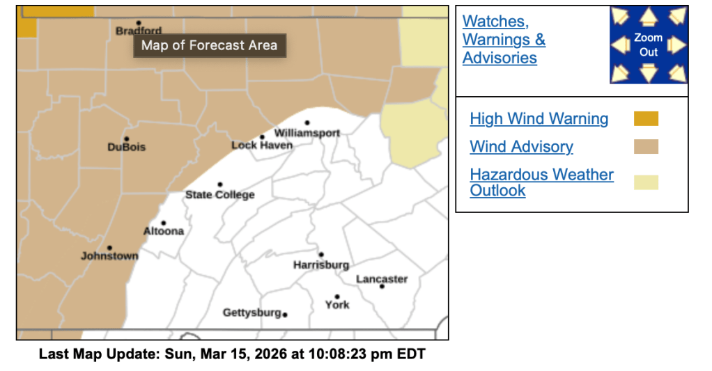
This morning temperatures will be in the mid to upper 40s. Winds this morning will be from the southeast between fifteen to twenty mph. Due to the stronger winds, the National Weather Service continues the Wind Advisory until 11 am. This morning we will be cloudy with some showers.
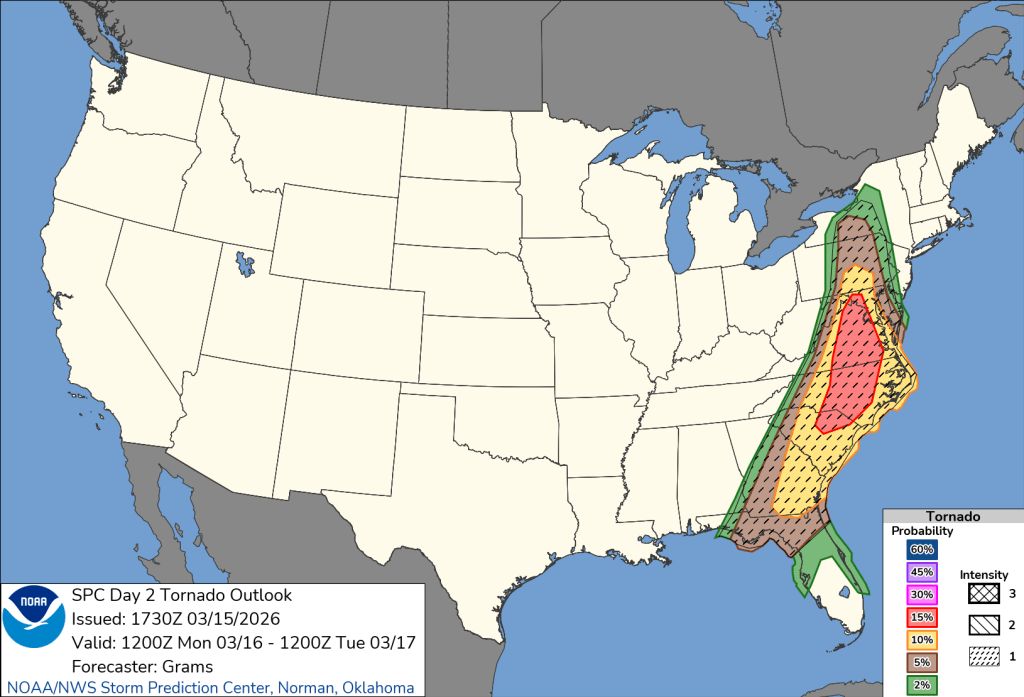
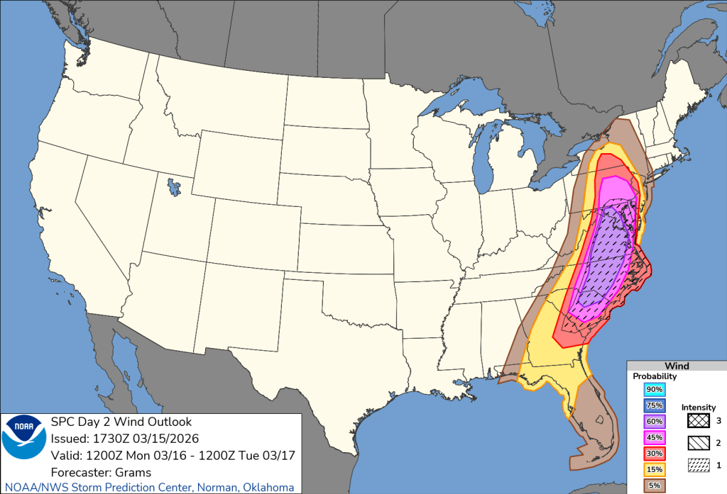
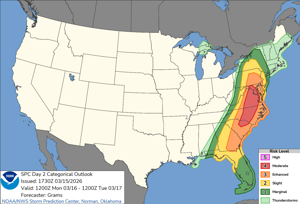
This afternoon a cold front will arrive. Ahead of it, we will see temperatures climbing, and if there is any sunshine, will add instability to the atmosphere. This afternoon with the crossing of the cold front, we could see strong to severe storms with damaging winds. The National Weather Service has put us under a slight risk for severe weather (2 out of 5). Just to our east, it is an enhanced risk. Please stay weather aware. Our biggest threat is damaging winds and even potentially a tornado.

Tonight cold air quickly arrives. We will see temperatures dropping into the lower to mid 20s. We will also see a wintry mix to some snowfall. Winds will be from the west between fifteen to twenty mph. Gusts will be up to 40 mph. Use caution, in some spots, there could be a dusting of snowfall on the ground by morning.
Tuesday will be a cold and blustery day. High temperatures will only make it to the mid to upper 20s.
Almanac for today (Altoona records since 1948):
Average High: 48°F
Average Low: 30°F
Average Precip: .10″
Record High: 74°F in 2012
Record Low: 9°F in 1992
Record Precip: .94” in 1982
Yesterday’s High: 52°F
Yesterday’s Low: 34°F
Yesterday’s highest wind speed: SE 25 mph G 37 mph
Sunrise: 7:23 am
Sunset: 7:21 pm

Leave a comment