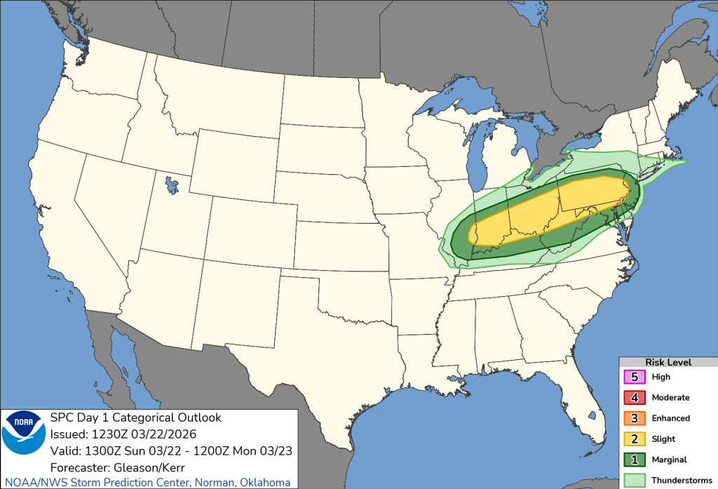
Happy Sunday! It will be unseasonably warm today ahead of a cold front. Temperatures will soar into the upper 70s. Later this afternoon and evening we will have scattered storms. Some of these storms could be strong to severe with hail and damaging winds. The National Weather Service has placed us under a slight risk for severe weather for this Sunday.
Tonight storms will turn into rainfall into Monday morning. Watch for ponding on the roadways, in some higher elevations as temperatures drop into Monday morning, there could be some slick and icy spots.
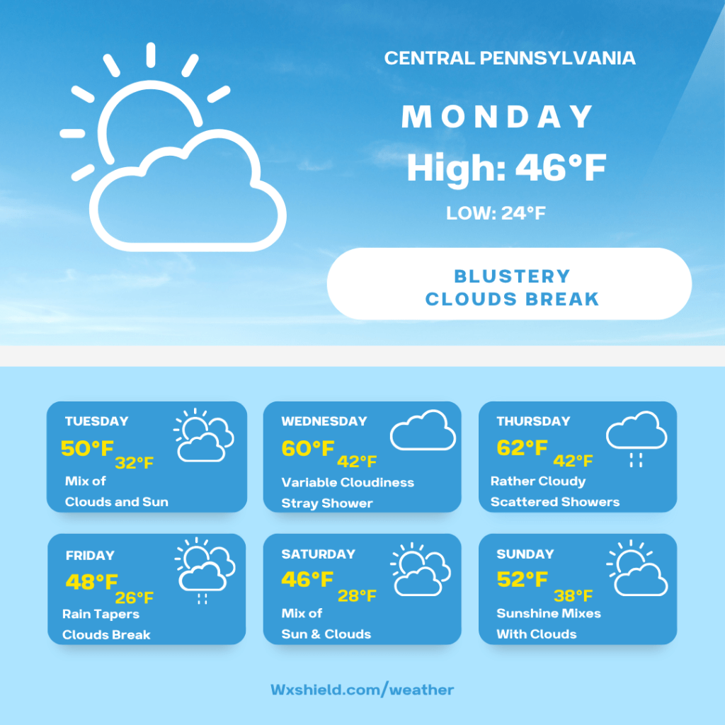
Temperatures on Monday morning will be in the upper 30s to lower 40s. Winds will be from the north between five to ten mph. Monday morning will be cloudy with a lingering shower or flurry.
Monday afternoon clouds will gradually begin to break leaving us with a partly cloudy sky. It will be a blustery afternoon. Winds will be from the northwest between ten to fifteen mph. Temperatures Monday will be in the mid to upper 40s.
Monday night we will be partly cloudy. Temperatures Monday night will be in the lower to mid 20s. Winds will continue from the northwest between ten to fifteen mph.
Tuesday will be a seasonable late March day. High temperatures will reach the upper 40s to lower 50s. Winds will be from the south between five to ten mph. Tuesday we will have a mix of clouds and sunshine. Tuesday night temperatures will be in the lower 30s. Tuesday night we will have a few clouds.
Wednesday high temperatures will be in the upper 50s to lower 60s. Wednesday we will have a variable cloudy sky with a stray shower. Most of us look to stay dry. Winds will be from the south between five to ten mph. Wednesday high temperatures will be in the lower 40s. Wednesday night we will have showers into Thursday morning.
Thursday high temperatures will be in the lower 60s. Winds will be from the southwest between ten to fifteen mph. Thursday will be mostly cloudy with scattered showers. Showers will turn into a steadier rain later Thursday night into Friday morning. Thursday night temperatures will be in the 40s.
Friday high temperatures will be in the mid to upper 40s. Winds will be from the northwest between ten to fifteen mph. It will be blustery behind the front. Friday we will see rain tapering off and clouds breaking for a bit of sunshine. Friday night will be chilly with temperatures in the upper 20s.
Saturday there will be a mix of clouds and sunshine. High temperatures on Saturday will be in the mid 40s. Winds will be from the west between five to ten mph. Saturday night we will see temperatures in the upper 20s with a mainly clear sky.
Sunday there will be sunshine mixing with a few clouds. High temperatures on Sunday will be in the lower 50s. Winds will be from the west between ten to fifteen mph. Sunday night we dip into the mid to upper 30s.
Monday high temperatures will be in the mid to upper 50s with clouds and sunshine.
Have an amazing and safe week!

Leave a comment