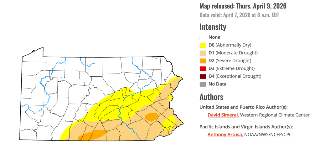
Happy Sunday! I hope you are having a nice weekend! Enjoy the seasonable air today, because we will be warming up for the work week. Our wildfire risk is elevated today and through the next week, please refrain from burning. A lot of southeastern Pennsylvania is still dealing with drought conditions. We will see a few showers or storms this week, but most stay dry and it doesn’t look like we see any soaking rain in the near future.
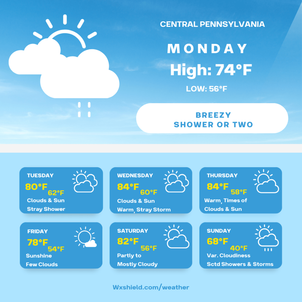
Monday morning we will be rather cloudy. Temperatures will be in the mid 50s. Winds will be from the south between five to ten mph.
Monday afternoon there will be a shower or two around. Otherwise, we will have more clouds compared to sunshine. It will be breezy. Winds will be from the west between ten to fifteen mph. Gusts could be upwards of 30 mph.
Monday night temperatures will not fall far, we will have lows in the upper 50s to lower 60s.
The rest of the week, warm air will be arriving from the south making us unseasonably warm.
Tuesday temperatures will be in the upper 70s to lower 80s. We will have a mix of clouds and sunshine. A shower or storm cannot be ruled out. Winds will be from the southwest between ten to fifteen mph. Tuesday night into early Wednesday morning, we will have scattered showers and storms, otherwise a cloudy sky.
Wednesday will be hot for April. High temperatures will reach into the mid 80s. We could see record breaking temperatures. Winds will be from the west southwest between ten to fifteen mph, ushering in the hotter air. Wednesday, a shower or storm cannot be ruled out, but mainly we stay dry. I think if we do see precipitation it will be in northern counties. Wednesday night temperatures will be in the lower 60s.
Thursday, high temperatures will be back into the mid 80s. Winds will be from the west southwest between ten to fifteen mph. Thursday we will have a partly cloudy sky. Thursday night temperatures will drop into the upper 50s. It will be cloudy and a shower cannot be ruled out.
Friday temperatures will be slightly lower, we will have high temperatures in the upper 70s to lower 80s. Friday, there will be sunshine with a few clouds. Winds will be from the west between five to ten mph. Friday night temperatures will drop into the lower 50s.
Saturday there will be a partly to mostly cloudy sky. High temperatures on Saturday will be in the lower 80s. Winds will be from the southwest between five to ten mph. Saturday night we will be cloudy. Low temperatures will be in the mid 50s.
Sunday we will have a cold front move through that will bring in scattered showers and storms. This front will also change our weather pattern back to more spring temperatures. Sunday we will have clouds, some sun with scattered showers and storms. High temperatures will reach the mid to upper 60s.
Monday we will have a mostly sunny sky. Our high temperatures on Monday will be in the upper 50s to lower 60s.
Have a nice week!

Leave a comment