I hope you all had a nice weekend! I got to spend time with my parents and see lots of flowers at Burket Farm and the Arboretum at Penn State! I’d call that a successful weekend! This week starts cold, but then we will turn seasonal.
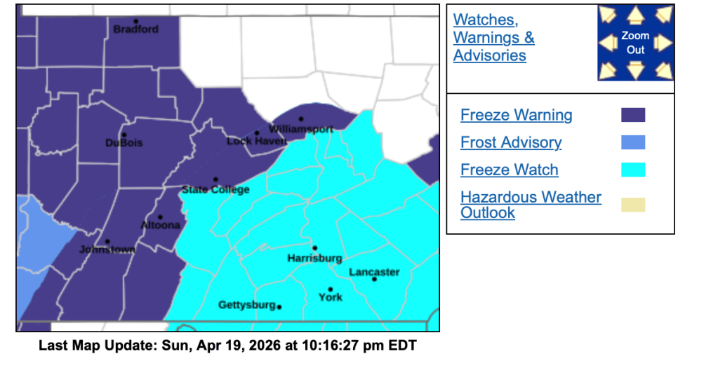
A Freeze Warning has been issued for the area until 9 am Monday. Bring in or cover any sensitive plants. We also have a Freeze Watch for Monday night into Tuesday morning.
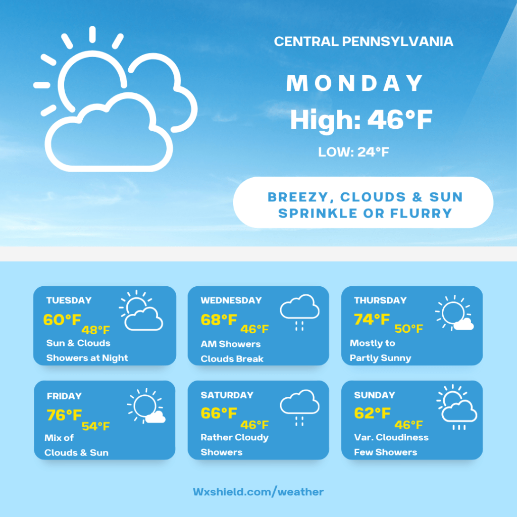
Temperatures Monday morning will be in the lower to mid 30s. Winds will be from the west between five to ten mph. We could see a shower or flurry with clouds and some sunshine.
Monday afternoon temperatures will be in the mid 40s. We will have clouds and some sun with a sprinkle or flurry. Winds will be from the northwest between ten to fifteen mph. It will be a breezy afternoon making the air feel cooler.
Monday night will be clear and cold. We will be most likely dealing with frost. Temperatures Monday night will dip inot the lower to mid 20s. The National Weather Service has issued a Frost Advisory into Tuesday morning.
Tuesday we will have a sunny to partly cloudy sky. Temperatures will be in the upper 50s to lower 60s. Winds will be from the southwest between five to ten mph. Tuesday night clouds increase and some showers move in. Temperatures will be in the mid to upper 40s.
Wednesday we will have a few morning showers and then clouds should try to break. High temperatures on Wednesday will be in the mid to upper 60s. Winds will be from the west between five to ten mph. Temperatures Wednesday night will be in the mid 40s.
Thursday high temperatures will be in the lower to mid 70s. We will have sunshine with a few passing clouds. Winds Thursday will be from the west northwest between five to ten mph. Thursday night temperatures drop into the upper 40s to lower 50s.
Friday high temperatures will be in the mid 70s. We will have a mix of clouds and sunshine. Winds will be from the west between five to ten mph. Friday night we will have times of rain into Saturday morning. Friday night temperatures will be in the lower 50s.
Saturday we will have a cloudy sky with showers. Winds will be from the south between five to ten mph. Saturday night temperatures will be in the 40s.
Sunday high temperatures will reach the lower 60s. We will have a variable cloudy sky with a shower or two.
Have a wonderful week!
Almanac for today (Altoona records since 1948):
Average High: 63°F
Average Low: 41°F
Average Precip: .11″
Record High: 87°F in 1976
Record Low: 27°F in 1988
Record Precip: 1.16” in 2008
Yesterday’s High: 51°F
Yesterday’s Low: 37°F
Yesterday’s highest wind speed: W 28 mph G 40 mph
Sunrise: 6:27 am
Sunset: 7:58 pm

Leave a comment