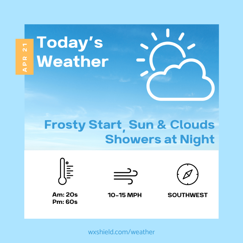
Good morning and happy Tuesday! We are starting off cold and frosty! This morning we will have a mainly clear sky. Winds will be from the northwest between five to ten mph.
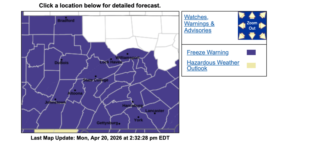
Temperatures this morning will be in the mid 20s. This could break a record! Our lowest temperature for this date was 26 degrees back in 1981! Due to the cold, the National Weather Service has issued a Freeze Warning for the area until 9 am. Hopefully you brought in any sensitive plants or covered them up!
This afternoon we should warm up nicely. We will have sunshine mixing with some clouds. High temperatures will reach into the lower 60s. Winds will be from the southwest between ten to fifteen mph.
Tonight clouds start to roll in, and late tonight into Wednesday morning there will be spotty showers. Temperatures tonight will be in the mid to upper 40s. Winds will be from the south between five to ten mph.
Have an awesome Tuesday! Stay warm!
Almanac for today (Altoona records since 1948):
Average High: 64°F
Average Low: 42°F
Average Precip: .11″
Record High: 86°F in 1985
Record Low: 26°F in 1981
Record Precip: 1.63” in 1955
Yesterday’s High: 42°F
Yesterday’s Low: 26°F
Yesterday’s highest wind speed: NW 20 mph G 36 mph
Sunrise: 6:25 am
Sunset: 7:58 pm

Leave a comment