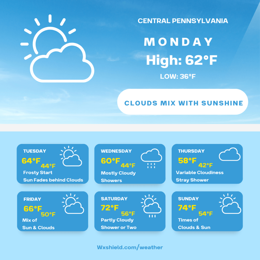
Good morning and happy Monday!
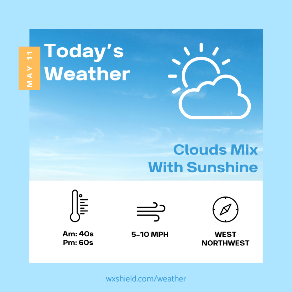
This morning temepratures will be in the lower 40s. Winds will be from the northwest between five to ten mph.
This afternoon we will have a mix of clouds and sunshine. Winds will be from the northwest between ten to fifteen mph. High temperatures will be in the lower 60s.
Tonight temperatures will be in the 30s. You’ll want to cover your plants into Tuesday morning as there could be a frost or a freeze. Winds will be from the northwest and will be light. Tonight we will have a mainly clear sky.
Tuesday we will have sun to start and slowly it will fade behind the clouds. High temperatures on Tuesday will be in the lower 60s. Winds will be light from the west. Tuesday night clouds thicken and temperatures will be in the lower 40s.
Wednesday high temepratures will be in the upper 50s to lower 60s. A low pressure system will move in. This will bring us a cloudy sky with times of rain and even some rumbles of thunder. Winds will be form the west northwest between five to ten mph. Wednesday night there will be showers. Temperatures Wednesday night will be in the lower to mid 40s.
Thursday high temperatures will be in the upper 50s to lower 60s. Winds will be fomr the west northwest between five to ten mph. Thursday we will have a variable cloudy sky. Thursday night temperatures will dip into the 40s.
Friday we will have a mix of sunshine and clouds as high pressure is around. High temperatures will be in the mid 60s. Winds will be from the north between five to ten mph. Friday night temperatures will be in the upper 40s to lower 50s.
Saturday we will have high temperatures in the upper 60s to lower 70s. Winds will be form the west northwest between five to ten mph. Saturday we will have times of clouds and sun with a shower or two. Saturday night temperatures will be in the 50s.
Sunday high temperatures will be in the lower to mid 70s. Winds will be from the west between ten to fifteen mph. Sunday there will be sunshine mixing with clouds. Sunday night temperatures will dip into the lower 50s.
Monday high pressure moves in. We will have high temepratures in the mid to upper 70s. Winds will be from the west and will be light. Monday night temperatures will be in the 60s.
Have an awesome week!
Almanac for today (Altoona records since 1948):
Average High: 70°F
Average Low: 48°F
Average Precip: .11″
Record High: 86°F in 1948
Record Low: 25°F in 1966
Record Precip: 1.88” in 1981
Yesterday’s High: 62°F
Yesterday’s Low: 47°F
Yesterday’s highest wind speed: N 17 mph G 25 mph
Sunrise: 6:01 am
Sunset: 8:19 pm

Leave a comment