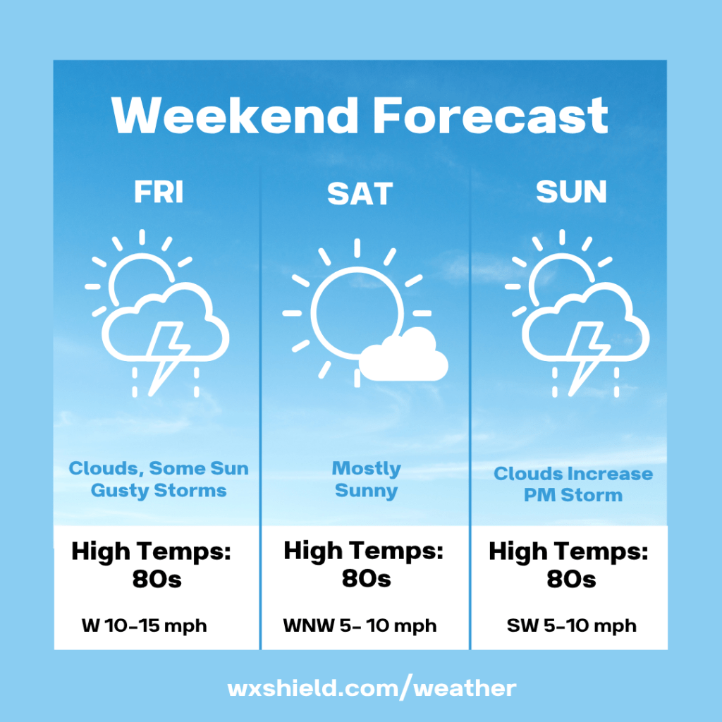
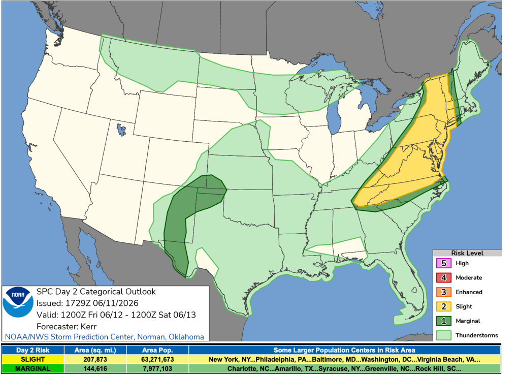
Happy Friday! We will have a cold front arriving today that could lead to gusty strong storms. You want to stay weather aware today. Today there is a slight risk of severe weather (2 out of 5).
Temperatures this morning will be in the upper 60s to lower 70s. Winds will be from the west between five to ten mph. We will have patchy clouds.
This afternoon is when we could see some strong to severe storms. Winds will be from the west between ten to fifteen mph. We will have clouds with some sunshine. Temperatures this afternoon will be in the mid to upper 80s.
Tonight the sky will gradually clear. Low temperatures tonight will dip into the upper 50s to lower 60s.
Saturday will be a beautiful day if you want to spend it outdoors. We will have plenty of sunshine with just a few clouds. High temperatures will be int he lower to mid 80s. Winds will be from the west northwest between five to ten mph. Saturday night temperatures will be in the mid to upper 50s.
Sunday we will have a partly cloudy sky to start. We will have clouds increasing. High temperatures will be in the upper 70s to lower 80s. Winds will be from the southwest between five to ten mph. Late Sunday another front arrives bringing a few showers and storms along with it. Sunday night temperatures will fall into the mid 50s.
Monday we will have a variable cloudy sky. High temperatures will be in the lower 70s with lower humidity.
Almanac for today (Altoona records since 1948):
Average High: 78°F
Average Low: 58°F
Average Precip: .11″
Record High: 90°F in 1984
Record Low: 40°F in 1980
Record Precip: 1.73” in 1959
Yesterday’s High: 91°F
Yesterday’s Low: 66°F
Yesterday’s highest wind speed: WNW 23 G 46
Sunrise: 5:42 am
Sunset: 8:44 pm


Leave a comment