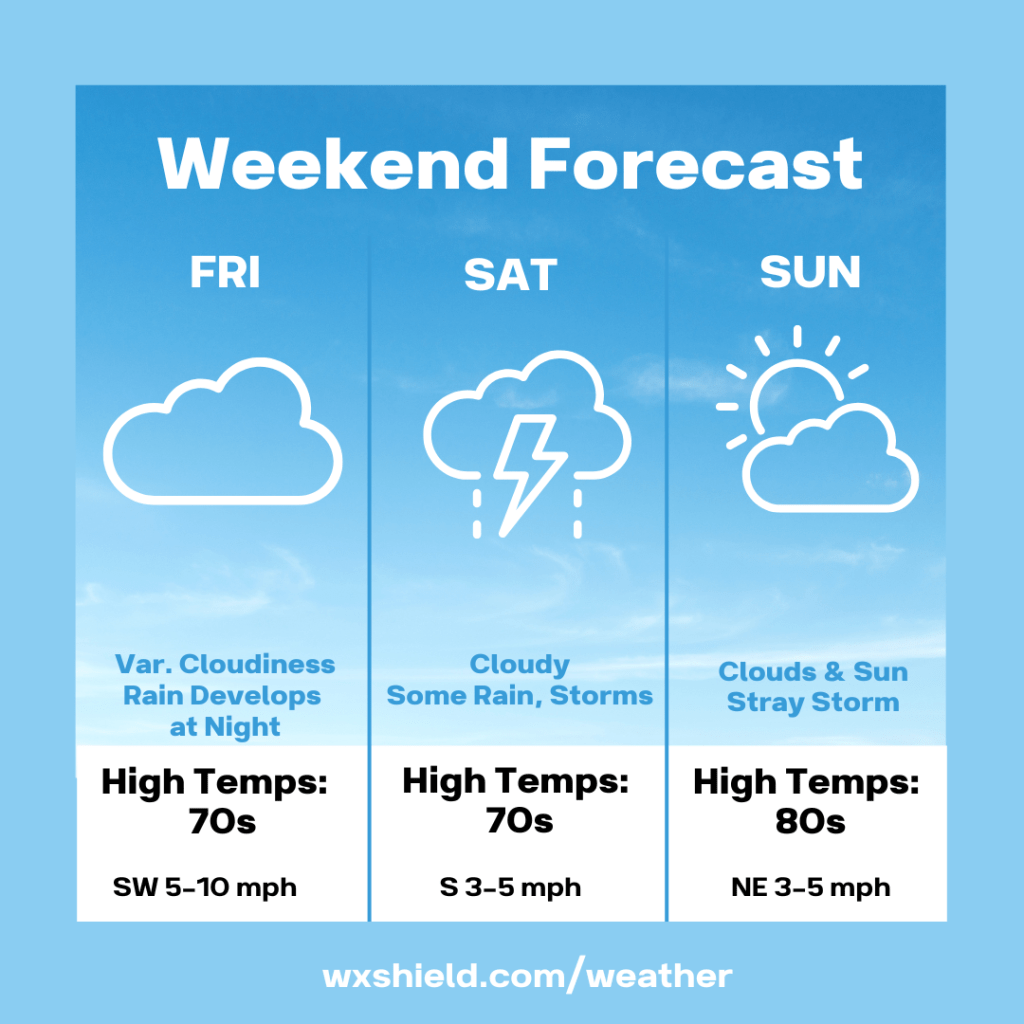
Good evening! We will have an unsettled weekend ahead as a slow moving system crosses Central PA. Next week, summer heat and humidity will really ramp up.
Friday morning temperatures will be in the lower 60s. We will have a cloudy start with some patchy fog. There could be a shower around. Winds will be from the south between five to ten mph.
Friday afternoon will have a variable cloudy sky. Temperatures will reach the upper 70s. If we see a little more in the way of sunshine, temperatures will reach the lower 80s. Winds will be from the west between five to ten mph. There could be a stray shower or storm.
Our next system approaches Friday night into Saturday morning. Temperatures Friday night will be in the lower to mid 60s. We will have a cloudy sky as rain develops. It does look like there will be more rain in southern counties. Winds will be calm to light.
Saturday high temperatures will be in the lower 70s. We will have a light southerly breeze between 3-5 mph. Saturday will be cloudy with times of rain or a few thunderstorms. Temperatures Saturday night will be in the upper 50s to lower 60s.
Sunday we will have temperatures in the lower 80s. It will be a more humid day. Sunday we will have a mix of clouds and sunshine. A shower or storm cannot be ruled out. Winds will be light from the northeast. Sunday night temperatures will be in the lower 60s.
Monday will be warm and humid. High temperatures on Monday will reach the upper 80s. Winds will be from the south between five to ten mph. Monday we will have a mix of clouds and sunshine. Monday night temperatures will be in the lower to mid 60s.
Have a good weekend!

Leave a comment