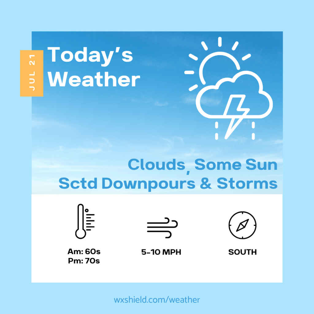
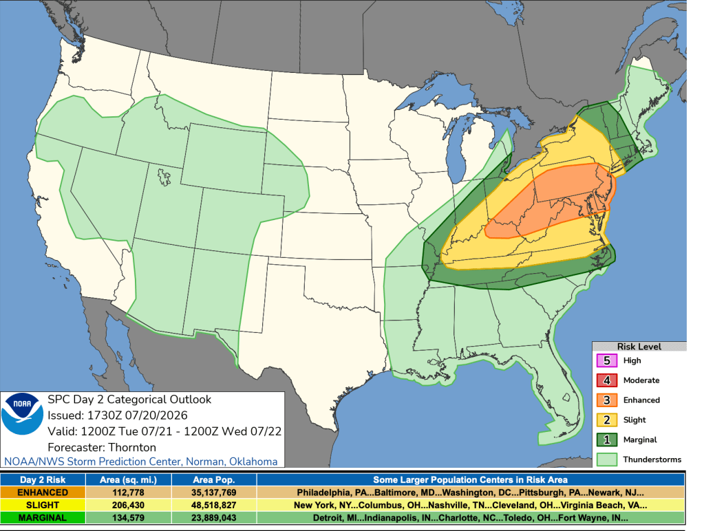
Good morning and happy Tuesday! Make sure to stay weather aware today. The National Weather Service has us under an enhanced risk (3 out of 5) for severe weather today. We could see damaging winds, hail, and even a tornado, alongside downpours.
This morning temperatures will be in the 60s. Winds will be from the south between five to ten mph. This morning will be rather cloudy.
This afternoon we will have clouds with some sunshine. There will be scattered downpours and strong to severe storms. Keep up to date with the forecast. Winds will be from the south between five to ten mph. High temperatures will reach into the upper 70s to lower 80s.
Tonight showers and storms will slowly taper off. We will have a cloudy sky. Temperatures tonight will fall into the 60s. Winds will be from the southwest.
Stay safe and have a nice day!
Almanac for today (Altoona records since 1948):
Average High: 83°F
Average Low: 62°F
Average Precip: .12″
Record High: 101°F in 2011
Record Low: 41°F in 1966
Record Precip: 1.50″ in 2020
Yesterday’s High: 80°F
Yesterday’s Low: 52°F
Yesterday’s highest wind speed: SE 9 mph
Sunrise: 6:00 am
Sunset: 8:38 pm
 Wx Shield
Leave a comment