Happy Sunday! I hope you have had a good weekend! We had a good one and got to spend time with my parents for my dad’s birthday!
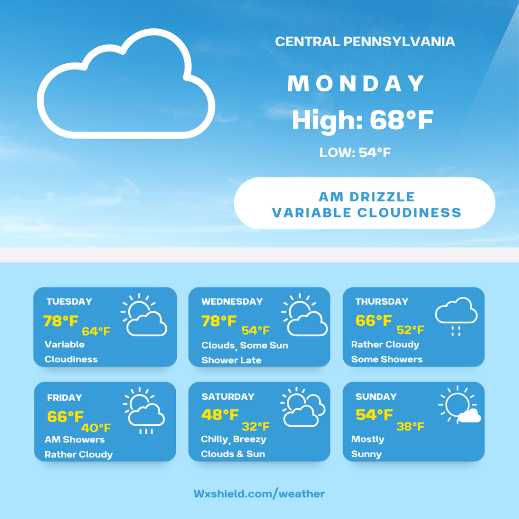
The week ahead is a rollercoaster. We will be warming up to begin the week and temperatures will come crashing down by the weekend.
Monday morning we will be cloudy with some drizzle. Temperatures on Monday morning will be in the mid 50s. Winds will be from the north between 3-5 mph.
Monday afternoon we will be rather cloudy with some peeks of sunshine. High temperatures on Monday will be in the upper 60s to lower 70s. Winds will be from the northwest between five to ten mph.
Monday night temperatures will be in the lower to mid 50s. Monday night we will be partly cloudy with patch fog. Temperatures Monday night will be in the lower to mid 50s. Winds will be from the northwest between five to ten mph.
Tuesday a system will be rolling through just to our north. That means we should see variable cloudiness, or a bit of an overcast sky. If you go to the northern border close to New York, we could be dealing with some showers. Temperatures on Tuesday will reach into the upper 70s to lower 80s. We have the potential to break a record high temperature. Tuesday winds will be from the southwest between five to ten mph. This is what will usher in the milder air. Tuesday night temperatures will be in the lower to mid 60s.
Wednesday we will be seeing clouds, a little sunshine. Late in the day on Wednesday we could have some showers around into Thursday. Temperatures Wednesday will be in the mid to upper 70s. Winds will be from the west between ten to fifteen mph. Wednesday night temperatures will be in the lower to mid 50s.
Thursday we will have a rather cloudy sky with some showers around. Temperatures on Thursday will be in the mid to upper 60s. Winds will be light from the northeast between 3-5 mph. Thursday night temperatures will be in the lower 50s.
Friday morning we could see a few showers around early, then clouds try to break. High temperatures on Friday will be in the mid to upper 60s. Winds will be from the west between 10-15 mph. Friday night colder air starts to arrive. Temperatures Friday night will dip into the upper 30s to lower 40s.
Saturday will be chilly and windy. Temperatures on Saturday will only reach into the mid to upper 40s. Winds will be from the northwest between 15-20 mph. Saturday we will have a mix of clouds and sunshine. There is the possibility to see a shower or two. Saturday night temperatures will fall to around the freezing mark of 32 degrees.
Sunday high temperatures will be in the lower to mid 50s. Winds will be from the west between five to ten mph. Sunday we will have a mostly sunny sky as high pressure begins to settle in. Temperatures Sunday night will fall into the upper 30s.
Monday high temperatures will be in the lower 60s. Monday we should also see a mostly sunny sky.
Have a great week!


Leave a Reply