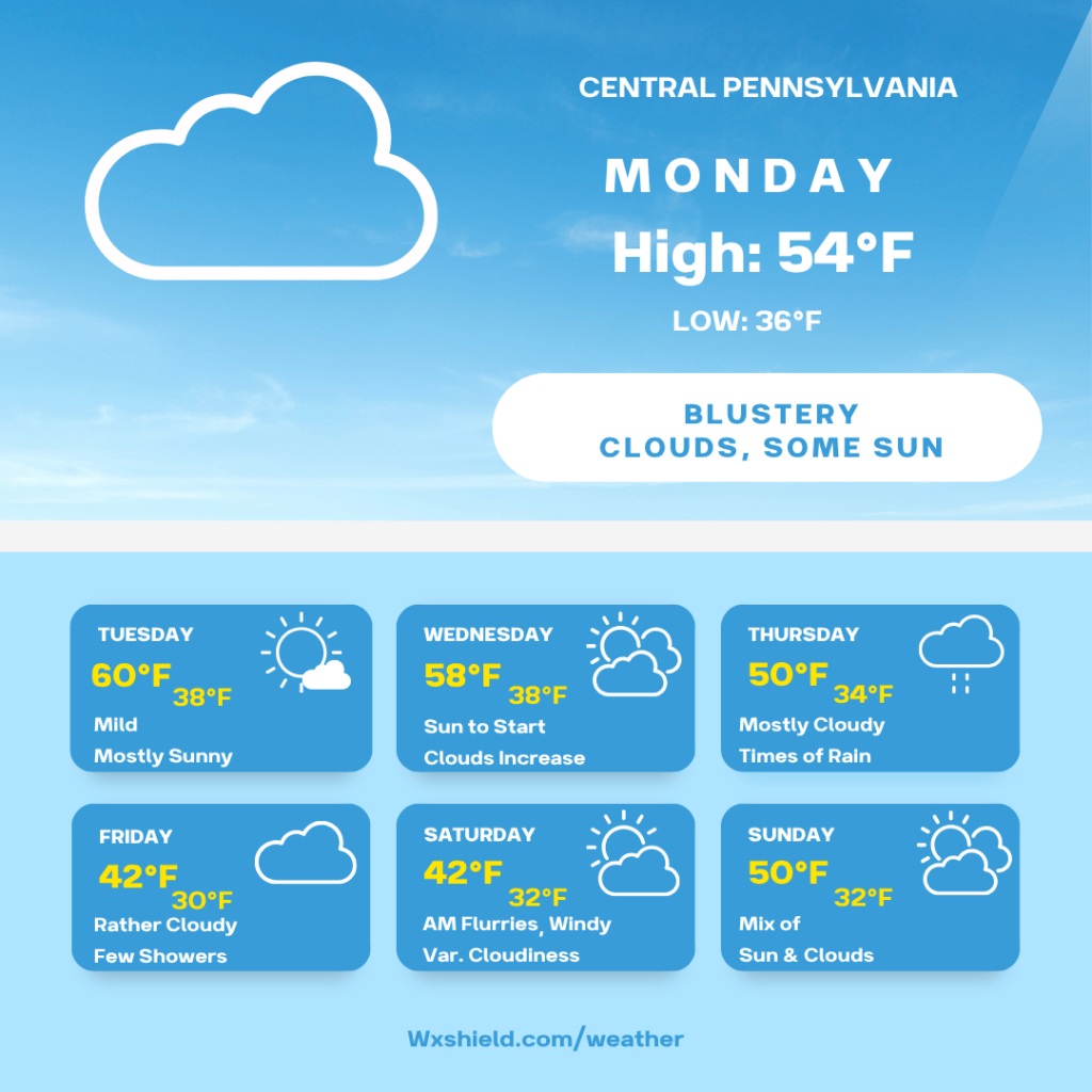
Happy Sunday! We’ve got a rollercoaster ride of weather this week, and potentially Friday and Saturday could see some snowflakes. Let’s dive into it!
Today we will see clouds decreasing allowing for a sunny afternoon. Temperatures today will reach the mid 50s and it will be breezy.
Monday morning temperatures will be in the mid 40s. We will have clouds increasing. Winds will be form the west between 10-15 mph.
Monday afternoon temperatures will be in the lower to mid 50s. Winds will be form the west northwest between fifteen to twenty mph. Winds could gust upwards of 25-30 mph. This will make the air feel cooler. Monday afternoon clouds will thicken, so we will see more clouds compared to sunshine. There could even be a sprinkle around.
Monday night clouds diminish and the winds will start to diminish too. Temperatures Monday night will be in the mid 30s. Winds will be from the west between five to ten mph.
Tuesday will be the nicest day of the week. We will see plenty of sunshine and blue sky. Winds will be from the west between ten to fifteen mph. Temperatures on Tuesday will soar into the upper 50s to lower 60s. Tuesday night temperatures will be in the upper 30s.
Wednesday for Veteran’s Day, high temperatures will be in the mid to upper 50s. We start off with sunshine, but clouds increase. Winds on Wednesday will be from the west between five to ten mph. Late Wednesday night into Thursday morning, a low pressure system arrives bringing in some showers.
Thursday will be cloudy with showers. A low pressure system is moving through. Winds will be from the south and will be light. It will be a cooler day due to the rain. High temperatures will be in the upper 40s to lower 50s. Thursday night temperatures will be in the lower to mid 30s.
Friday we will have showers lingering and potentially mixing with a few snowflakes. Temperatures on Friday will only reach into the upper 30s to lower 40s for highs. Winds will be from the northwest between ten to fifteen mph. Friday night temperatures will tumble into the upper 20s to lower 30s.
Saturday we could see some morning flurries. After that, there will be a variable cloudy sky. It will be a blustery and cold day. High temperatures will only reach the upper 30s to lower 40s. Winds will be from the northwest between fifteen to twenty mph. This wind will make the air feel colder. Saturday night temperatures will dip to around the freezing mark of 32 degrees.
Sunday will be more seasonable. High temperatures Sunday will reach to around the 50 degree mark. Sunday we will have a mix of clouds and sunshine. Winds on Sunday will be from the west between five to ten mph. Sunday night temperatures dip into the lower 30s.
Monday high temperatures will be back to near 50 degrees with a mostly sunny sky.
Have an amazing week! I’ll keep you updated on what to expect by the end of the week.


Leave a Reply