I hope you had a wonderful weekend! We have a drier week ahead for us across Central PA.
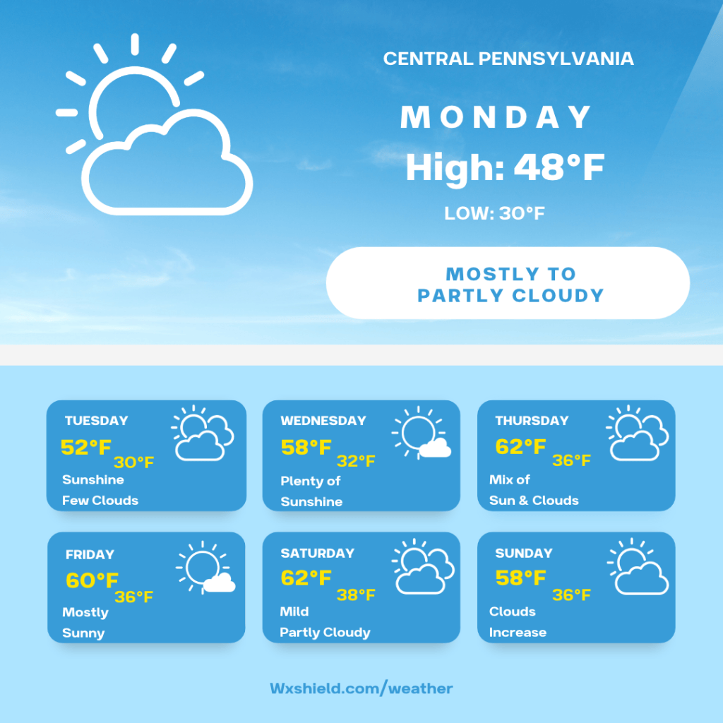
Temperatures Monday morning will be in the mid to upper 30s. Winds will be from the northwest between ten to fifteen mph. We will start the day off cloudy with a lingering sprinkle or shower. Otherwise it will be cloudy.
Monday afternoon we should see the clouds break a little bit. Temperatures will reach the mid to upper 40s. Winds will be from the northwest between five to ten mph.
Monday night temperatures will fall into the upper 20s to lower 30s. Winds will be from the northwest between five to ten mph. We could see some patchy fog into Tuesday morning.
Temperatures on Tuesday will climb into the lower 50s by afternoon. Tuesday a ridge of high pressure will set up over Central PA and stay with us for most of the week. Winds on Tuesday will be in from the northwest between five to ten mph. Tuesday night temperatures dip into the upper 20s to lower 30s.
Wednesday there will be plenty of sunshine and blue sky. High temperatures on Wednesday will be in the mid to upper 50s. Winds will be from the west between five to ten mph. Wednesday night temperatures fall to around the freezing mark of 32 degrees.
Thursday high pressure continues to stick around. We will have sunshine mixing in with some clouds. High temperatures on Thursday will be in the lower 60s. Winds will be from the west southwest between 3-5 mph. Thursday night temperatures fall into the mid 30s.
Friday will be mild and mostly sunny. High temperatures on Friday will climb to around the 60 degree mark. Winds will be from the west between five to ten mph. Friday night temperatures dip into the mid 30s.
Saturday we will have a partly cloudy day. The mild weather continues with high temperatures in the lower 60s. Winds will be from the south between five to ten mph. Saturday night temperatures dip into the upper 30s.
Sunday is our next chance to maybe see some precipitation later in the day. Clouds will increase on Sunday and there could be some showers later into the afternoon and evening. High temperatures on Sunday will be in the mid 50s. Winds will be from the west between five to ten mph. Sunday night temperatures drop into the upper 30s.
Monday we will have variable cloudiness with high temperatures in the mid 40s.
Have a great week!


Leave a Reply