Happy Sunday! We’ve had a really nice mild stretch of weather across Central PA. That will be changing as we head into this week. Colder air will be settling in and it will feel more like late November.
Temperatures today will reach the upper 50s to lower 60s. We will have a cloudy sky. It looks like at this point, the coastal low will not impact us as it moves up the eastern seaboard, and we will just see some clouds from it.
Tonight into Monday a cold front will cross our area. This will bring in some colder air.
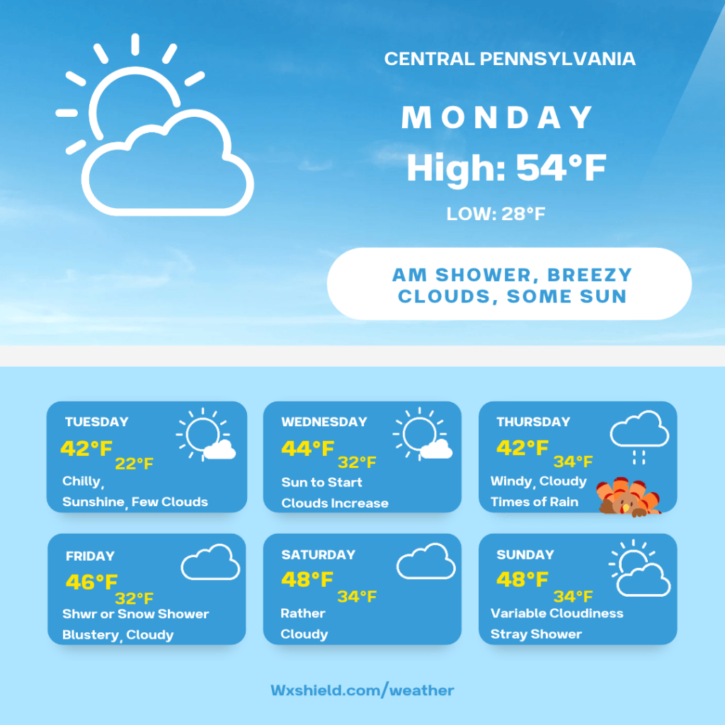
Monday morning starts off not too bad with temperatures in the mid to upper 40s. Winds will be from the southwest between five to ten mph. Monday morning will be cloudy with a stray shower.
Monday afternoon temperatures reach into the lower to mid 50s. Winds on Monday will turn to the northwest after the front moves through. Winds will be between 10-15 mph with gusts upwards of 25 mph. Monday afternoon there will be a variable cloudy sky. Depending on the timing of the front, there could be a stray shower in the afternoon.
Monday night temperatures will tumble into the upper 20s to lower 30s. We should see a partially to mainly clear sky. Winds will continue from the northwest between five to ten mph.
Tuesday will be chilly. High temperatures will be in the lower to mid 40s. Winds will be from the north between five to ten mph. Tuesday we will have high pressure over us. This will bring us a mix of sunshine and clouds. Tuesday night looks clear to view the November full moon. Tuesday night temperatures drop into the lower to mid 20s.
Wednesday morning starts off cold and clear. As the day goes along, we will see another coastal low trying to move in from the south. This means sunshine will fade behind the clouds as the day progresses. Depending on how fast this low moves, we will have to keep an eye on it. Temperatures on Wednesday will reach the lower to mid 40s for highs. Winds will be from the east between ten to fifteen mph. Wednesday night will be cloudy with rain and snow showers developing.
Thanksgiving day the coastal low will have impacts to us in Central PA. It is not out of the cards this pushes east like the system we are dealing with today and it ends up not as rainy. You will want to stay up to date with the forecast because it will be changing. Right now, it looks like a cloudy day with times of rain. It will also be windy. Winds will be from the north between 15-20 mph. Temperatures on Thanksgiving will reach into the upper 30s to lower 40s. Thanksgiving night temperatures will be in the upper 30s to lower 40s. We will continue to see some rain with a few snowflakes mixed in.
Friday the coastal low moves out. In its wake, we will have lake effect rain and snow showers. Friday there will be a variable cloudy sky. High temperatures on Friday will be in the lower 40s. Winds will be from the west between ten to fifteen mph. This wind will make the air feel colder. Friday night temperatures will be in the lower 30s.
Saturday high temperatures will make it into the mid 40s. This is seasonable for this time of the year. Winds on Saturday will be from the west between five to ten mph. Saturday night temperatures will fall into the lower 30s.
Sunday there could be another low pressure system moving in bringing some precipitation, it is a little too far out for specifics. High temperatures on Sunday will be in the 40s.
Monday it looks like we will have a partly cloudy sky with high temperatures in the mid to upper 40s.
Have a wonderful and safe Thanksgiving week!


Leave a Reply