Happy Monday! We have a stormy start to the week, but overall not a washout this week.
Click here for your 7-Day Outlook.
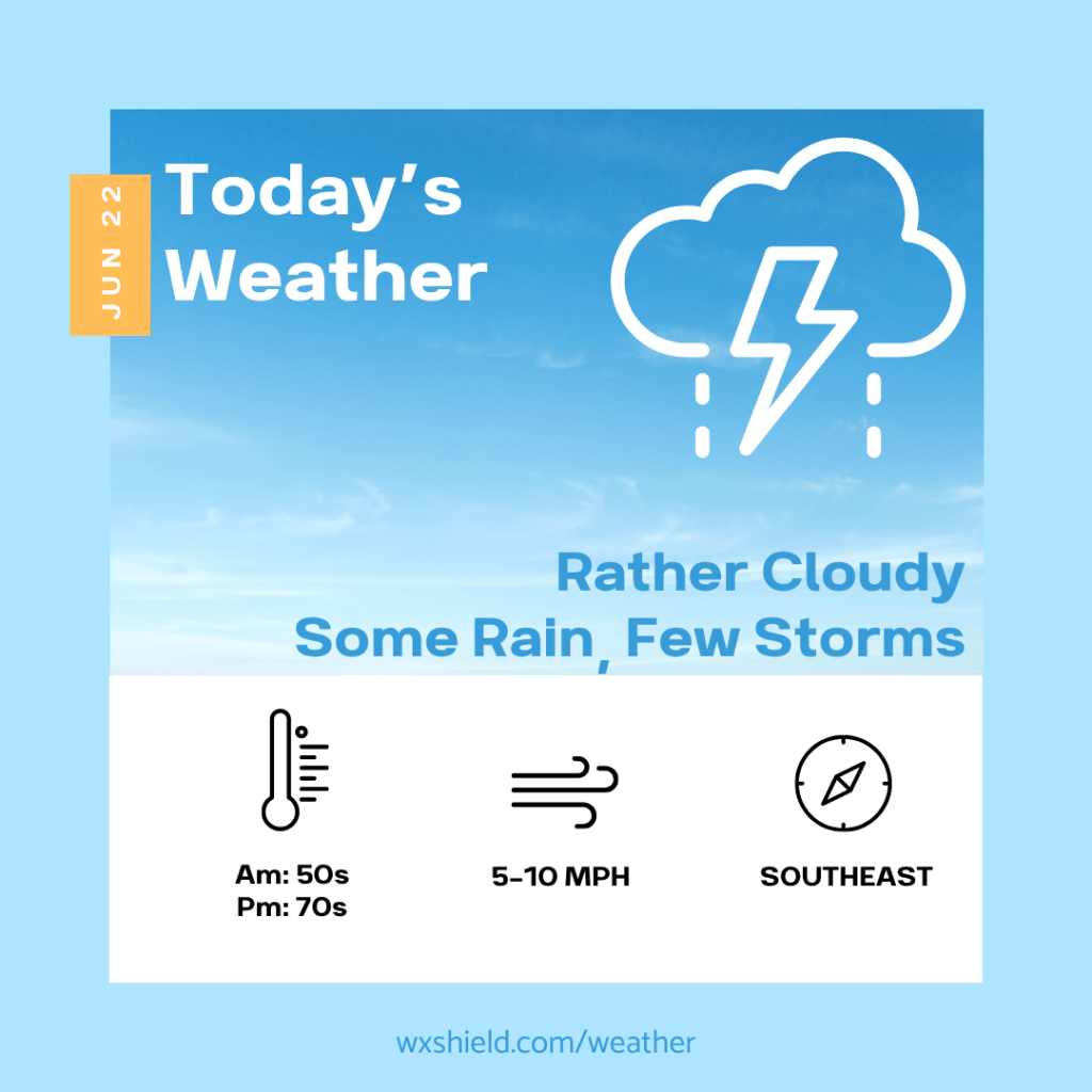
Today a low pressure system arrives. We will be cloudy and more humid. This morning temperatures will be in the upper 50s to lower 60s. We will start the day with times of rain. Some pockets of rain throughout the day could be downpours, and in areas of poor drainage we could see pooling of water. If you come across a road covered in water, turn around and take a different route.
This afternoon we stay rather cloudy with some showers and storms. Any storm again could contain gusty winds and downpours. High temperatures will be in the mid 70s. Winds will be from the southeast between five to ten mph.
Tonight we will see showers tapering off. Temperatures will be in the upper 50s.
Tuesday very early we could see a lingering shower. The rest of the day the sky will be clearing for plenty of sunshine.
Almanac for today (Altoona records since 1948):
Average High: 80°F
Average Low: 60°F
Average Precip: .11″
Record High: 96°F in 2024
Record Low: 39°F in 1963
Record Precip: 4.39” in 1972
Yesterday’s High: °F
Yesterday’s Low: °F
Yesterday’s highest wind speed:
Sunrise: 5:43 am
Sunset: 8:47 pm

Leave a comment