Happy Sunday! Today we will continue to be drizzly and cloudy, but high pressure will build in Monday and stick with us for most of the week.
Temperatures Monday morning will be in the upper 40s. We will start off with a partly cloudy sky with some patchy fog. Winds will be light from the west between 3-5 mph.
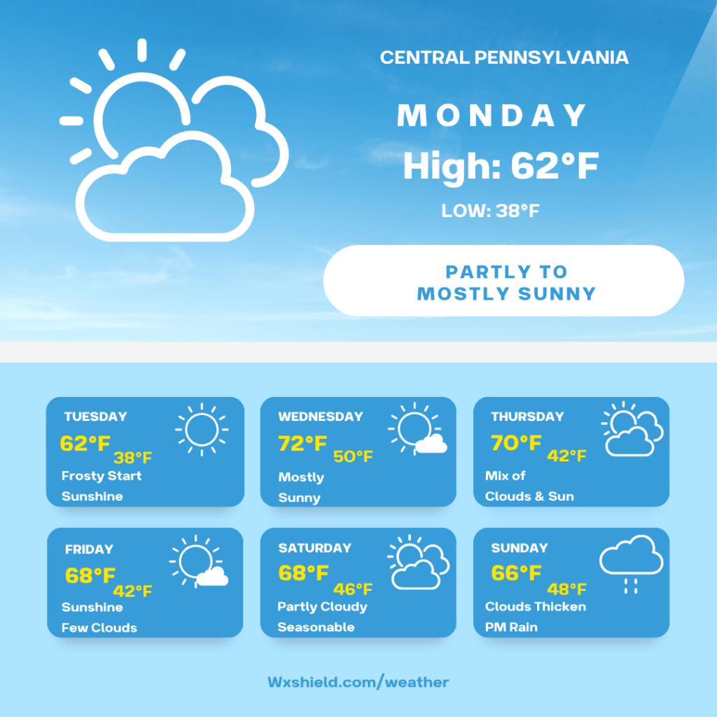
Temperatures Monday afternoon will be in the mid to upper 60s. Winds will be from the northwest between five to ten mph. This afternoon we will see a partly cloudy sky slowly turning to a sunny sky.
Monday night temperatures will be in the mid to upper 30s. It will be a chilly night and we could have a freeze into Tuesday morning. If you have any sensitive plants, make suer to keep them covered or bring them inside. Monday night we will have a clear sky.
Tuesday starts off frosty. As the day goes on, high temperatures will reach the lower 60s. Winds on Tuesday will be light from the west. Tuesday we will have high pressure, which means blue sky and sunshine. Tuesday night temperatures will be in the upper 30s. Once again, we could be dealing with a frost or freeze.
Wednesday high temperatures will reach the lower 70s. Winds will be from the southwest between five to ten mph. Wednesday we will have a mostly sunny day. A weakening front will try to cross the area Wednesday night into Thursday morning. Right now it looks like a dry front, so we will just see patchy clouds Wednesday night into Thursday morning. Wednesday night temperatures will be in the upper 40s to lower 50s.
Thursday high temperatures will be in the upper 60s to lower 70s. Winds will be from the west between five to ten mph. Thursday we will have a mix of clouds and sun. Thursday night temperatures will be in the lower to mid 40s.
Friday high temperatures will be in the upper 60s. Friday we will have a mostly sunny day. Winds will be from the west between five to ten mph. Friday night temperatures will be in the 40s.
Saturday high temperatures will be in the mid to upper 60s. Winds will be from east between five to ten mph. Saturday we will have a partly cloudy sky. Saturday right now looks dry for the White Out game at Beaver Stadium. Saturday night temperatures will dip into the mid to upper 40s.
Sunday clouds will increase and some rain will arrive with a low pressure system. High temperatures on Sunday will be in the mid 60s. Winds will be from the southeast between ten to fifteen mph. Sunday night temperatures will be in the upper 40s to lower 50s. We will be cloudy with times of rain.
Monday the rain will taper off and high temperatures will be in the mid to upper 60s.
Have a nice week!


Leave a comment